Reviewed by Wendy Lipke
As expected from the title Brilliant maps, Ian Wright has compiled a book of maps, but if you want to find the usual information found in an atlas then this is not the book for you. This publication, I believe, is more suited as a coffee table book in a home or in a doctor’s waiting room, where people browse through to while away the time. However, it would be a great resource for the trivia buff.
Have you ever wondered which nations have the tallest men? Or the colour of passports throughout the world? If your brain is wired thus, then this book might be just what you need.
This well-produced, over 200-page hard covered book is divided into eleven topic areas with a ten-page introduction and fifteen-page credit section.
Topic areas in the atlas embrace information that is diverse, relating to People and Populations, including fifteen maps comparing size of land, population density, average age and height as well as migrant populations. The second group of maps addresses issues relating to Religion and Politics, while the section on Power compares economic issues in the individual countries of the world.
Maps displayed in the Culture section focus on sport, heavy metal bands, cola brands in Germany and for some reason, place names with more than twenty letters. This is followed by a section on Customs some of which evaded me as to why they would be considered to be important, such as the decimal point vs decimal comma vs other decimal separations. However, I concede that the map highlighting world plug-socket information could be helpful to world travellers.
The maps comparing Friends and Enemies cover a broad range of topics about historical invasions and which countries claim friendship or foe status with which other countries. There are other sections on History and Geography including an interesting map of Doggerland. Where or what is Doggerland? I hear you say. Here’s your answer! Apparently, “18,000 years ago the landmass known as Doggerland connected Britain with continental Europe” (142).
The remaining sections contain maps of information relating to National Identity, Crime and Punishment and Nature. I did wonder who would want to compare the colour of passports, or need to know the number of executions in the US since 1976 or evaluate numbers concerning Sharks vs Humans, Who kills whom? I guess someone might.
The maps provided are sharp and the colours chosen ensure that no one section dominates another, however because the maps spread across two pages it is inevitable that some sections of the map will fall into the ditch.
According to the author ‘some context is often not only helpful but necessary to understand the map’ (xvii). He provides this through the use of simplified coloured keys. Some maps do require more use of words to achieve the purpose and this has been provided.
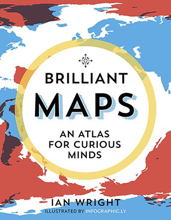
The cover of the book which is based on original maps is appropriate to the content and was designed by Dan Mogford. The text in the Contents and Credit sections was beautifully spaced on the page and thus easy to read. However, I was a bit disappointed that the Introduction section, by comparison, appeared to be very cramped on the page and therefore not as easy to read especially when a double page is spread before the reader.
The introduction is very comprehensive and tells us much about the author and his interest in maps and his use of them to enable his other passion, walking. We are informed that he spent many years exploring London on foot, being the first person to walk the entire 2015 version of the Tube Map.
Ian Wright, majored in history and political science with a particular focus on economics at the University of Toronto. However, it was in London that he set up his Brilliant Maps Website with help from the MapPorn community. MapPorn posts ‘subreddit’ or messages on the Reddit’s website which describes itself as the ‘front page of the internet’(xiv).
He tells us that this book takes its lead from his popular Brilliant Maps website which ‘curates, collects and contextualizes maps from around the Internet’ (xi). From analysing the flow of traffic to this site, Wright believes that ‘curiosity about the world around us is something that we all have in common’ (xi) and this was sufficient to require his book. I wonder if this is enough evidence upon which to publish a book when more and more people are using the internet to source information for free.
For this publication, the author has included maps he has found to be the most popular on his website and to ‘mix them up with other kinds of maps’ (xvii). He suggests that the inclusion of maps, like Chile is a ridiculously long country and Countries with no rivers, will change our present perspectives on how we look at other places on the world map.
On first viewing I felt the book contained a slight American bias, always comparing the US to other parts of the world, but on closer inspection this may not be the case.
I am still not convinced that the information in the maps in this book is really as important as the author suggests, but this is a well-presented book which is easy to read. Although, apart from the introduction, the contents pages and the credits, there is very little other reading to do.
The back cover of the book Brilliant Maps an atlas for curious minds invites readers to ‘see the world anew through these surprising, witty and revelatory maps’. If you believe you are of the curious minded then you could find something of interest in this book.
(2019)
Granta
Ian Wright
ISBN:978-1-84627-661-3
233pp; $39.99